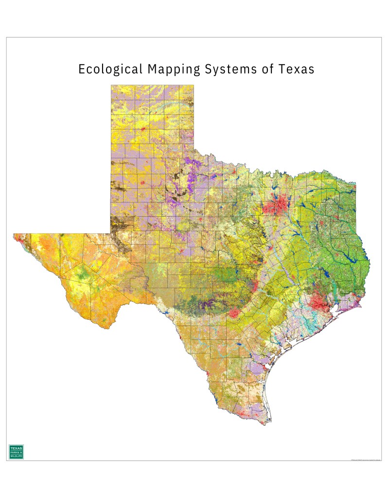
Texas lies at a crossroads for abiotic and biotic diversity from all parts of the United States. To the east, it is part of the pine forests of the southeastern U.S. In its northeastern corner, the hardwood forest belt enters the state. The Great Plains of the central United States run through the center of Texas, the Mexican subtropics jut into the South, and Rocky Mountain habitats and southwestern desert habitats can be found in West Texas. The patterns in Texas’ topography, geology, climate, and soils lead to a complexity of vegetation communities and wildlife populations. With all this diversity a map of all the vegetation types in Texas, such as the one shown below, can look very complicated.
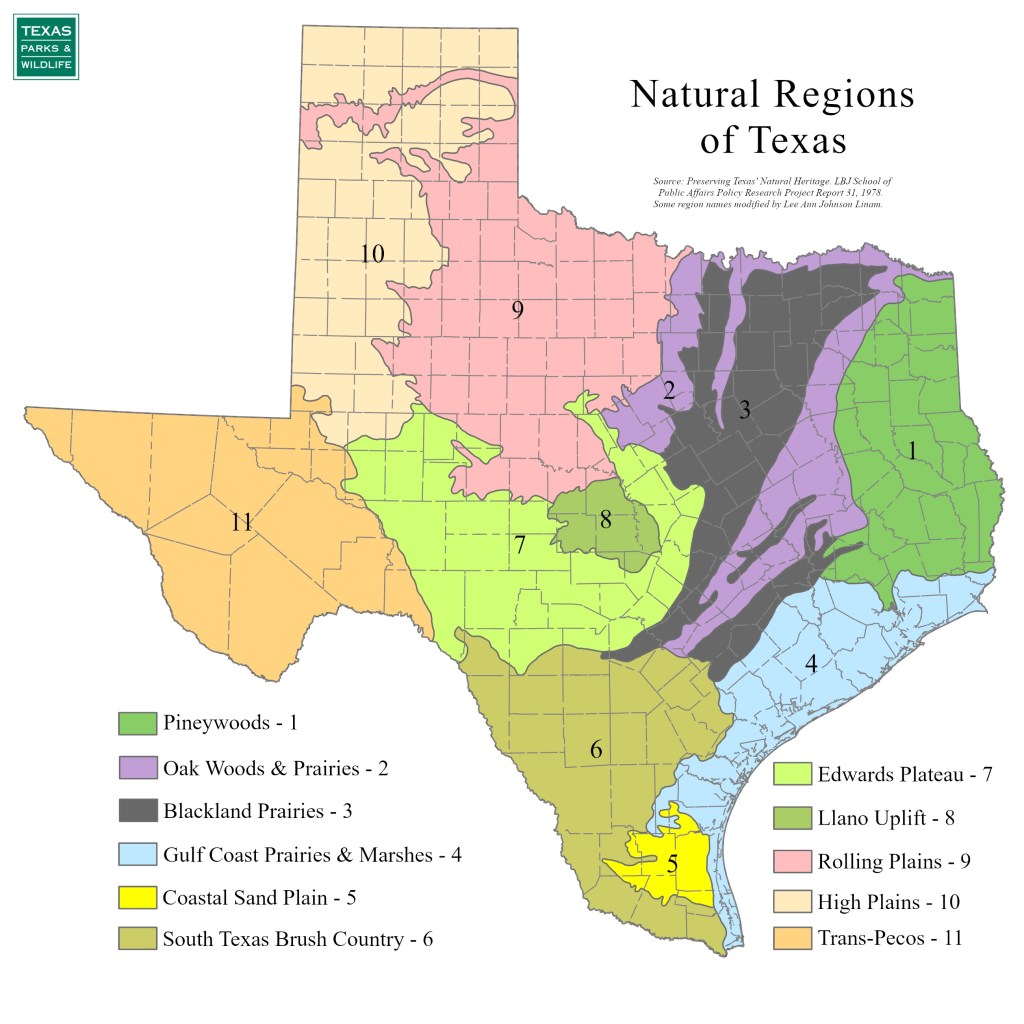
Despite the vegetation complexity, ecologists have noticed patterns in ecosystem distribution and have proposed several maps to summarize these patterns. These ecoregion maps represent major ecosystems defined by distinctive geography, soils, rainfall and climate patterns, and characteristic species of plants and animals. Many different, but similar, ecoregion maps for Texas exist. For the purposes of this book, we will rely on a Natural Regions of Texas map produced by the Lyndon B. Johnson School of Public Policy as part of a document entitled “Preserving Texas’ Natural Heritage” published in 1978. The Natural Regions map divides Texas into 11 ecoregions.
Subscribe to get access
Get access to the rest of this chapter and the entire contents of Texas Wildlife Science for a one-time subscription fee.

Leave a comment